
About Us
MetaTours is a database of 360° aerial imagery for the Real Estate and Tourism Industries
Since 2017, we’ve provided aerial imagery for clients across British Columbia, with a focus on the commercial real estate industry. We learned that many real estate firms need drone imagery quickly and taken from all directions above a property, something traditional stock photo sites do not offer. Using 360-degree imagery, MetaTours offers a new photo licensing solution for the Real Estate industry by empowering users to frame up and capture their own images. Simply search for an address, select nearby imagery, and frame your drone photo of choice for instant download.

How it Works

EXPLORE
Use the map to see our coverage and find an area of interest to explore. Click any of the blue dots to access 360 drone imagery at that location.
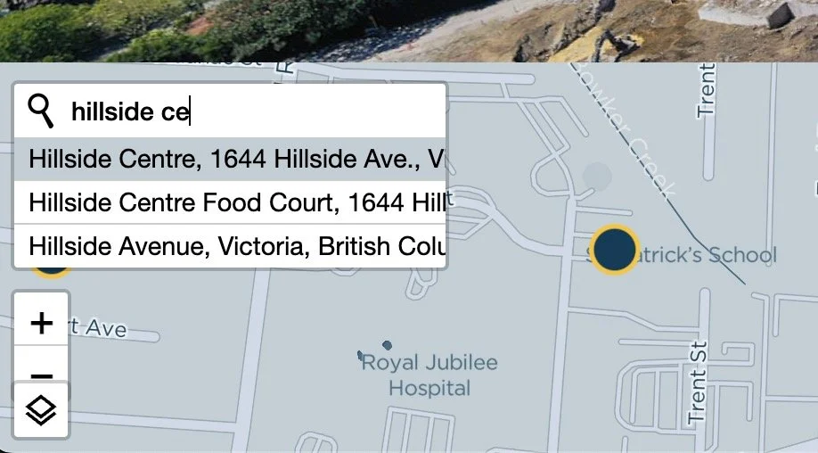
SEARCH
After entering a 360 drone photo location, click the search icon to find an address and navigate to the nearest aerial view.
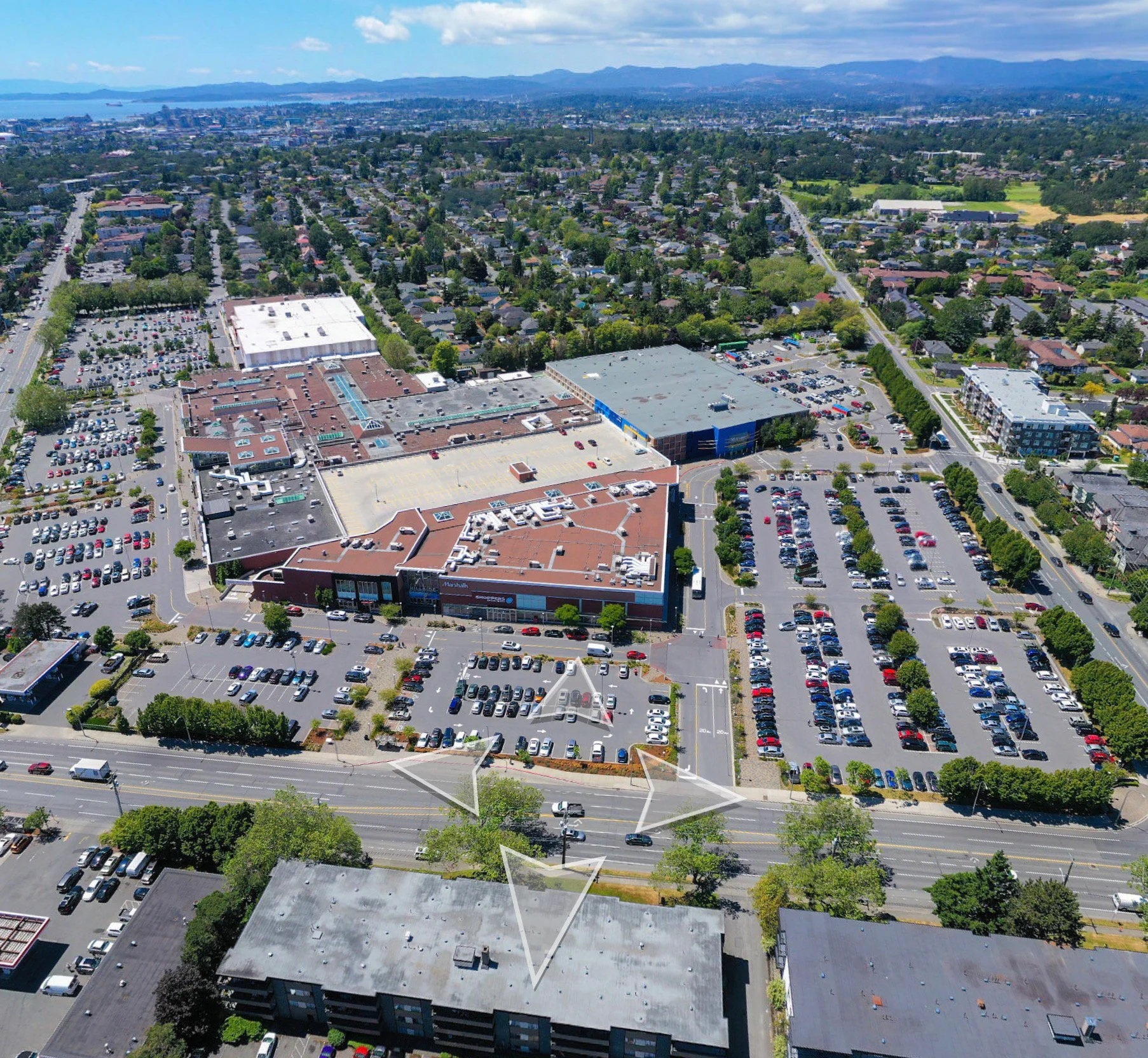
CAPTURE
Interact with the image to frame your own aerial photo. Once satisfied, click the screenshot button for instant licensing and download.

FAQs
-
The Skyway is a network of 360° drone images captured in urban areas across Victoria and Vancouver. It offers real estate professionals immediate access to an extensive database of aerial imagery, ready for instant licensing and download to enhance their listings.
-
Our goal is to update our imagery every 2-3 years to maintain accuracy and relevance. If you need a specific area updated sooner, please contact us to request a new shoot, and we will coordinate the update.
-
Photo licensing from MetaTours costs $10 per screen capture for personal use, and $50 per screen capture for commercial use. We plan to introduce subscription plans soon, allowing customers to bulk order screen captures at a lower monthly cost.
-
Screen captures are taken at the resolution of the monitor you are using to view the imagery. When you capture a photo, we remove all on-screen elements, providing you with the drone imagery at your current viewing angle and screen resolution.
-
All our drone imagery is captured using sub-250 gram 'micro' drones, which are lightweight and can be flown in controlled airspace. We coordinate flights with local Air Traffic Control where necessary to ensure safety and compliance with regulations. At each photo location, the drone takes numerous photos in all directions, which we then stitch together into a high-resolution 360-degree panorama for optimal viewing.
-
Yes! We have a team of licensed drone operators and photographers who are ready to help with all your photo marketing needs. Get in touch with us today to book your custom photo shoot.
-
If you encounter any bugs or have any feedback for us on our MetaTours platform, feel free to email info@metatours.ca or fill out our email submission form on our Contact page.
Our Team
-

Danny de Clare
Co-Founder, Principal
-

Ryan Varchol
Co-Founder, Creative Director